What are LiDAR Mapping Services?
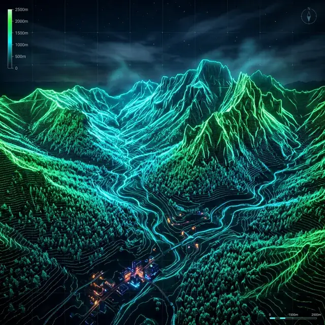
LiDAR mapping (Light Detection and Ranging) uses laser pulses to measure distances to the Earth's surface with extreme precision. Unlike traditional satellite imagery, LiDAR can penetrate dense vegetation, revealing the true ground surfacethe Bare Earth.
Our LiDAR mapping services focus on processing massive point clouds into clean, usable formats. We provide Digital Terrain Models (DTM), Digital Surface Models (DSM), and high-resolution contour lines for civil engineering, forestry, and archaeological surveys.
Using our Online LiDAR Viewer, you can explore high-definition topographic data directly in your browser, visualizing complex landscapes in 3D without the need for specialized software.
Advanced Point Cloud
Processing & Filtering
We specialize in large-scale dataset processing. Our workflow includes automated and manual classification to ensure cm-level accuracy in our Digital Terrain Models.
Ready-to-use Formats for GIS & CAD
Export your data as DXF contours, GeoTIFF elevation models, or tiled point cloudsfully compatible with Civil 3D, ArcGIS, QGIS, and Global Mapper.
LiDAR Mapping Applications
Archaeology
Discover hidden ancient structures, Roman roads, and forgotten settlements buried under dense forest canopies. LiDAR archaeology is the modern gold standard for heritage management.
Forestry Management
Inventory tree heights, calculate biomass, and monitor forest health. Our Canopy Height Models (CHM) provide detailed vertical structure data for precise management.
Civil Engineering
Accurate topographic surveys for road design, pipeline planning, and landfill volume calculations. LiDAR mapping reduces field survey time by up to 80%.
Flood Modeling
Simulate water flow and identify flood risks for urban planning and insurance assessment. High-precision DTMs are critical for reliable hydrological models.
Renewable Energy
Site analysis for wind farms and solar parks. Assess slope eligibility and shading factors using detailed LiDAR terrains.
Environmental Science
Study coastal erosion, landslide susceptibility, and ecosystem changes with multi-temporal LiDAR mapping analysis.
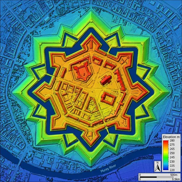
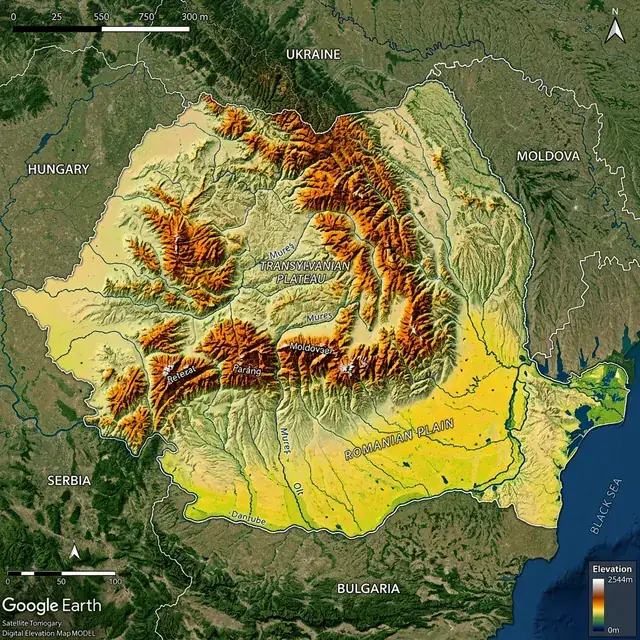
Global LiDAR Map Collection
Explore our featured processed LiDAR mapshigh-resolution terrain models across Europe and beyond.